Predicting tomorrow's floods, today
Discover how Rita leverages advanced spatial modeling to anticipate flood risks, supporting proactive planning and disaster mitigation in urban environments like Philadelphia.
Understanding flood risk with data
This report details a spatial predictive model for estimating flood inundation probability using a machine-learning approach grounded in logistic regression. Using the 2013 Calgary flood as a training case, the model identifies relationships between environmental variables such as elevation, slope, land cover, and proximity to water, and observed flood outcomes. These relationships are then applied to predict potential flooding in Philadelphia under a similar extreme weather scenario. This transferable, data-driven method helps anticipate flood risk in comparable urban environments, supporting proactive planning and disaster mitigation.
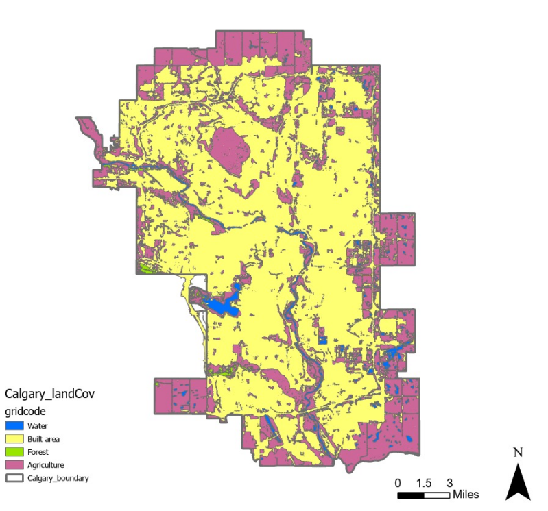
For this project, we meticulously gathered diverse data sets, including land use data, hydrological study data, and detailed slope and elevation digital model (EDM) data. Utilizing these comprehensive inputs, we developed a robust regression model to analyze and predict flood patterns. Our methodical approach ensures that the model is built on a solid foundation of real-world environmental variables, enhancing its accuracy and applicability for urban planning and flood mitigation strategies
Innovative tools for urban planning
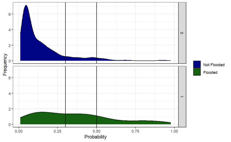
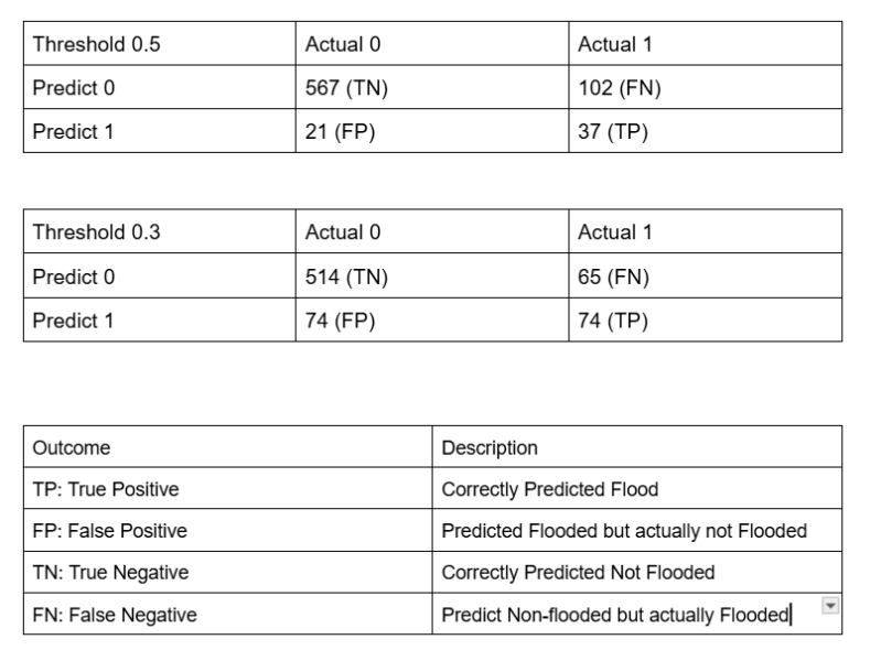
The model demonstrates that spatial logistic regression can be a useful tool for identifying broad patterns of flood risk, especially concerning proximity to water and topographic variation. While it performs well at predicting non-flooded areas, its lower sensitivity limits its ability to accurately identify all flooded locations, particularly along major river corridors. When applied to Philadelphia, the model produces plausible results, with higher flood probabilities concentrated along the Schuylkill River and in low-lying, impervious areas of the city. This innovative approach provides a technical tool to enhance the planning process.
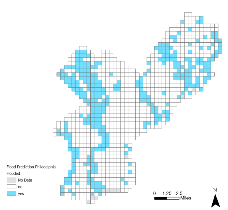
Impact and insights for Philadelphia
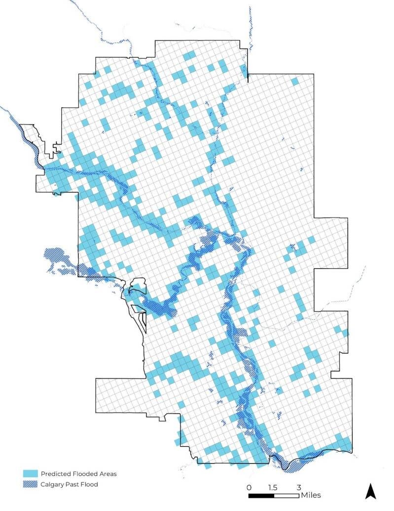
We applied the model with the same set of variables to predict flooding in Philadelphia. The results clearly show higher flood probabilities along the Schuylkill River and in parts of Northeast Philadelphia. This spatial pattern is consistent with expected flood dynamics, where areas near the Schuylkill River exhibit higher risk due to their proximity to a major water body. Overflow and backwater effects in these areas significantly increase the likelihood of flooding, aligning with the model’s strong negative relationship between distance to water and flood probability. Additionally, some high-risk areas in Northeast Philadelphia are associated with lower elevation and relatively flat terrain, which tend to accumulate surface runoff. Urban land cover and impervious surfaces in these areas further exacerbate flooding by reducing infiltration and increasing runoff, underscoring the model's effectiveness in identifying critical vulnerability zones.
Full report here :